
New National Benchmark for Floodplain Management
Brisbane River Strategic Floodplain Management Plan sets new National Benchmark
Brisbane River Strategic Floodplain Management Plan sets new National Benchmark
17 June 2019
Following widespread flooding across Queensland in 2010 and 2011, the Queensland Floods Commission of Inquiry was established to assess the management of floods across the state, including the processes undertaken by government agencies to prepare and plan for floods.
One of the key recommendations from the Inquiry was that Councils should develop comprehensive floodplain management plans, including in the Brisbane River floodplain where 14,000 properties were inundated in 2011. The first stage of this process was the development of hydrologic and hydraulic models, delivered by Aurecon and BMT respectively as part of the Brisbane River Catchment Flood Study. Following that study, the Queensland Government appointed us to prepare the Brisbane River Strategic Floodplain Management Plan; a comprehensive roadmap to guide floodplain management in the lower catchment.
State Government Minister, Cameron Dick has described as “a new national benchmark for floodplain management”.
After 18 months of intensive effort from our team, project partners, client and stakeholders, the Strategic Plan has recently been released. The Strategic Plan helps stakeholders and the community better understand current and future flood risks and identifies regionally consistent approaches to strengthen flood resilience across the lower Brisbane River floodplain. Key deliverables from the study include:
The Strategic Plan identifies 52 actions that guide how the Queensland and local governments will work together to better manage flood risk now and into the future. In addition, 17 of those actions have state-wide application to support the flood resilience of all Queensland communities.
Our flood modelling expertise began in our Brisbane office more than 40 years ago and has since been applied across Australia and internationally.
Discover more about our environment capabilities available here

19 June 2026
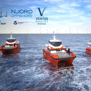
Strategic framework enables scalable engineering support and creates a new platform for collaboration on commercial ship projects

5 February 2025
Proud to be included in the prestigious Financial Times UK’s Leading Management Consultants & Consulting Networks List 2025, reaffirming our reputation as a leading consultancy.
10 June 2024
Ventus Marine has selected BMT's 27m Crew Transfer Vessel (CTV) design for the construction of four new vessels by Strategic Marine. These vessels are destined for offshore wind markets in Taiwan and Europe.

12 January 2022
We're thrilled to today announce that Principal Consultant, Corinna Weller, has been awarded a commendation for both her and her team’s dedication, specifically for supporting digital capabilities transformation within UK National Specialist Policing.