Marine surveying 4.0
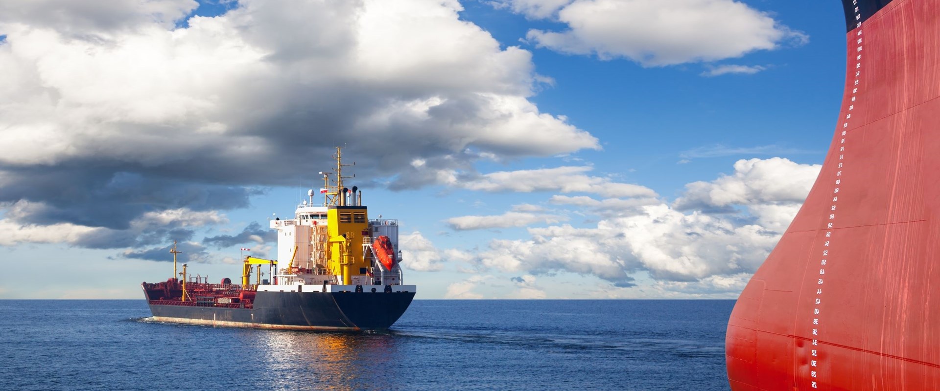
For decades, the modus operandi of marine surveyors has not changed much. Sent by insurance companies or ship operators, the surveyor’s task is to collect evidence, to collect facts.
For decades, the modus operandi of marine surveyors has not changed much. Sent by insurance companies or ship operators, the surveyor’s task is to collect evidence, to collect facts.
13 December 2022
These facts are used by customers to get a better understanding of local circumstances, be it to establish the condition of a vessel or marine object, or to ascertain the extent and cause of damage to it. In general, collecting evidence consists of the following:
Once the job is done, the surveyor returns to his office and starts processing this information into a report. Sometimes this is a tough process, with the speed and quality of the outcome largely depending on the editorial skills of the surveyor.
The appearance of these reports has not changed much over the years. Although nowadays reports are sent in a digital format as opposed to printing them and posting them to customers in the past, it is still a relatively static document, consisting of narrative text and pictures.
To some extent, that type of reporting will continue to serve a purpose also in future, or at least will continue to satisfy the needs of a selected group of customers. Solid ‘hard copy’ evidence still holds a relatively high value when this evidence is perused in, for example, litigation proceedings.
But, for the majority of situations, alternative, less formal methods of information exchange may become more viable in future. In this respect the ‘report’ may disappear over time, being replaced by a more comprehensive process that is better described as information transferal.
To understand why this is an inevitable change, we need to understand that there are two processes that are acting on the maritime landscape. Both bear a relation with technological developments. The first process is the development of the digital world around us, the second is the effect this development has on the relation between the surveyor and his customer.
The position that the internet has established in our world is unprecedented. We live in a world where we feel we need to be continuously connected with each other. With the 5G coverage expected to reach a global percentage of 95% in 2026[1] and 5G reaching already 85% that same year, it is fair to say that we are seldom out of range.
Following that, we also strive to be connected to all the objects around us, which has led to the Internet of Things (IoT). In 2021 already 10 billion devices were connected to the internet, with an exponential growth up to more than 25 billion in 2030[2]. These are incredible numbers to digest, with every second another 127 devices connecting to the internet.
It is therefore no surprise that the IoT is an innovation which is rapidly making its way also into the maritime world, being an essential part of the 4th industrial revolution, or shorter Industry 4.0.
Stakeholders ashore want to be connected to ships at sea, having real time access to information about the vessel and her cargo. Active manipulation of the ships’ systems is a certain next step. And we have to accept that this is still just the prelude to fully autonomous shipping, the development of which today has already reached a market size of around $90 billion and expecting to almost double towards 2030[3].
Once we reach the stage that ships sail our world fully autonomously, the work of a marine surveyor is most certainly turned upside down. We could say that at that point in time we should be ready for Marine Surveying 4.0. Today an important part of collecting evidence during a marine investigation, is interviewing the crew, if not only because most casualties have a root cause in human error. For ships without crew members, such interviews would obviously no longer be applicable. In fact, for autonomous ships, information does not necessarily need to be collected by a surveyor, because that information was probably already downloaded to shore much earlier.
Still, we have to accept that full implementation of autonomous shipping is still more than a decade away. Although there are various roadmaps that lead to implementation of level 3 autonomous sailing for coastal ships in 2025, large scale implementation on the world’s fleet, including ocean-going vessels up to full autonomy (level 5), is not yet on the horizon. Whilst the technology develops fast, it is expected that implementation will be slowed down by the need to adjust legislation, regulations and legal frameworks.
But also, on the road towards full autonomous shipping, there are various stages of innovation, where ways that data is managed changes. For each of these stages, also the work of a marine surveyor requires change.
Surveyors will need to stay up to date with new technologies and assess to what extent these dictate other methods of evidence collection.
Technological developments are further intertwined with the second ongoing process, being the changing working relation between surveyor and customer. As described earlier, the way surveyors work dates from the old days, where the surveyor was the only possibility for a customer to get some eyes and ears on the ground. Before we had mobile phones and e-mail, the surveyor would accept his assignment by phone, disappear to the vessel for an uncertain period of time, only to report back to his customers once he had made his way back to the office.
Nowadays, accepting that we have many more ways to communicate, customers increasingly demand immediate updates. Often surveyors are urged to send pictures or even respond to e-mails whilst they are still in the middle of their on-board investigations. In addition, there is an increasing appreciation amongst customers for additional information sources, such as video footage, for example from drones.
This customer's perspective, pushed forward by the digital world, is something that surveyors will need to accept and adapt to. Technologies need to be embraced and put to work in their day-to-day business. For this, surveyors need to accept that these technologies can be an advantage to their work.
Every surveyor knows that it is sometimes a challenge to translate survey findings into a coherent and comprehensible survey report. This is certainly so, but not exclusively, if the surveyor is required to send a report in a language that is not his mother tongue. With changing views on how information can be exchanged, static reports that sometimes still fail to properly relay essential details, may become obsolete.
In addition, it is expected that more specialised techniques will become available that immediately aid the surveyor. Imagine how useful it would be if information that is collected visually, for example by (augmented reality) headsets worn by the surveyor, is real-time uploaded to the cloud. This will allow cloud-based software to use AI-based algorithms to immediately interpret that information, sending information and guidance back to the surveyor.
A development that goes hand in hand with the above, is remote surveying. Particularly during the pandemic this seems to have become a buzzword, but it is not always well understood, or at least is being explained in different ways. Remote surveying can be defined as a situation where the specialist (the marine surveyor) is not physically present on board but relies on others to provide the required information. Many of the Class societies have rolled out remote surveying programmes over the last years, likely accelerated by pandemic-induced travel restrictions.
Whilst it is accepted that such remote surveying solutions may be suitable for specifically outlined surveys or condition assessments, at this stage they still seem less suitable for most casualty investigations.
Casualty investigations do not follow a predefined route and often require considerable improvisation from the attending surveyor. This is particularly why specialists are still needed on site. But this does not exclude that these specialists start using new evolving techniques assisting them on the job.
At this moment ‘Marine Surveying 4.0’ is a work in progress. Neither the technology currently available, nor the demands from customers require an overnight change. But it is inevitable that we will have to start preparing for these changes today.

Chloe Yarrien
Maritime Autonomous Systems (MAS) are moving from concept to operational reality. Across defence and commercial maritime sectors, organisations are exploring how autonomy can improve operational effectiveness, increase persistence, reduce risk to personnel and enable new ways of working.

Panagiotis Kasionis
Coal cargoes remain a high-risk “routine” trade. Panagiotis Kasionis, explores key risks, regulatory changes and practical insights for managing exposure across the supply chain.

Thomas Hendrikx
When cargo operations go wrong, the true challenge often lies beyond the technical cause. In this thought leadership piece, Thomas Hendrikx explores how proactive remediation, from rapid fact‑finding to stabilising operations and aligning multiple stakeholders, protects time, money and reputation. He explains why the real value isn’t just solving the visible problem, but preventing the next one.

Paddy Rynders
Mandatory container loss reporting is now a global requirement under IMO regulations. Discover what this means for safety, transparency, and how the industry can turn compliance into prevention.