25 October 2022
In Queensland, significant progress has been made over the past seven years toward coastal hazard resilience and adaptation planning by coastal local governments, largely as part of the QCoast2100 program.
Funded by the Queensland State Government,
‘[QCoast 2100] represents an unprecedented opportunity for local governments impacted by coastal hazards to get on the front foot in adaptation planning to implement cost-effective mitigation measures over the medium and long term, plan for development and growth, budget for higher costs, collaborate regionally and seek investment opportunities.’
The team at BMT, along with our project partners, are proud to have played an important role in the QCCoast2100 program. This has included involvement in the early stages of the program by assisting the Local Government Association of Queensland (LGAQ) with the review of the minimum standards and guidelines, through to project scoping and delivery of Coastal Hazard Adaptation Strategies (CHAS) with our valued local government clients. Along the way our project teams have been able to observe, analyse, map, evaluate and recommend hazard adaptation approaches across the breadth of our diverse Queensland coastline from the Gold Coast to the Torres Strait.
In 2022, the QCoast2100 2.0 program approved a further $3 million ‘top up’ funding package focussed on assisting local authorities to finish development of their strategies as well as investment in a range of ‘demonstration’ local implementation projects.
As we move into this implementation phase, the next steps will be critical to embedding success. In particular, local governments will now need to focus on implementing the actions identified in their CHAS documents, which will include a broad range of planning, consultation and on-ground resilience and adaptation actions.
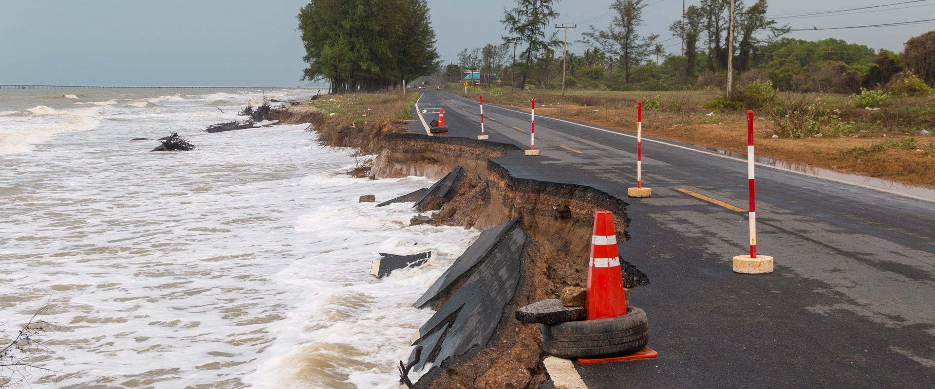
For existing assets and development in hazard areas, these actions may involve hard decisions that will need to be undertaken in close collaboration with the community and likely will need to occur in a staged manner over a long period of time. However, for new development, decisions will need to be taken now around siting and design standards to avoid or minimise significant impacts from hazards such as such as sea level rise on future generations.
As every coastal locality is subtly different, it is right to resist the urge to move to a programmatic solution toward implementation. However, there are clearly some important considerations to think about, some of these are presented below.
Communicating current and future hazard risk continues to be a vexing issue. While the accuracy of hazard modelling and mapping has improved significantly over the past decades, there are several timeframes to consider in terms of near-term risk (say within a decadal timeframe of planning scheme reviews) and increasing risk with projected sea level rise across erosion and storm tide impacts as part of future conditions in 2050 and 2100. How we explain concepts such as annual recurrence intervals (ARI) and annual exceedance probabilities (AEP) that sit behind mapping are also important as larger storm events become more common.
In New South Wales there have been provisions in place for some time under State legislation that provide for properties mapped as being affected by various natural hazards (including coastal hazards) to include a registration certificate that attaches to the land title and can be searched through traditional legal conveyancing. This approach is instructive to signalling existing risks from hazards to current landowners as well as identifying potential future risks to the property’s successor in title.
While this approach is something that could also be investigated in Queensland, it is clear that risk communication and engagement with community cannot stop at the completion of CHAS and updated hazard mapping. Instead, it becomes even more critical as implementation actions are beginning to be contemplated. This is essential for affected landowners; but also underlies the need for continued education of and genuine engagement with our broader communities on coastal hazards and the associated risks which are vital to achieving robust and practical adaptation outcomes that retain our unique coastal identities.
Given the amenity, recreational, ecological and economic values of beaches and foreshores to residents and local businesses reliant on tourism, it is not surprising that many CHASs placed an emphasis on beach nourishment, dune vegetation, wetland and estuarine bank restoration and other ‘nature-based’ solutions to coastal hazard resilience. Invariably though, these solutions are going to need additional on-going funding that can be applied to address an increasing frequency of erosion events.
Many nature-based coastal solutions will also rely on accessible and suitable volumes of sand for beach nourishment and dune restoration works and the machinery and plant to be able to implement these schemes. Queensland has a great advantage over many other States in that it allows marine and estuarine sand extraction to occur at appropriate locations and provides subsidised royalties for local authorities to use this material for beneficial uses; but this will invariably involve multiple levels of Government in deciding future borrow areas and approvals for sand access and translocation.
As shown by QCoast2100 2.0, there is strong support for State Government to continue to be involved in implementation to ensure there is guidance around the State’s interest, an acceptable level of consistency and equity is applied to coastal hazard adaptation solutions and there is continued investment in data collection and analysis such as mapping and engineering options assessment to support decision making. However, we will also likely see an increasing role for the Commonwealth Government, working with the States to fund implementation. A good example of this is the National Emergency Management Agency’s $50 million Coastal and Estuarine Risk Mitigation Program in the 2022-23 financial year which will be invested to help assist communities to mitigate disasters relating to coastal hazards.
It is also imperative that local government consider how to involve the private sector more effectively in the implementation of the strategies. The CHAS studies are a blueprint that will help to ensure that our coastal cities, towns and communities are viable into the future and all stakeholders must be part of the journey. As the climate continues to change there will be a need for costly interventions and effort should be made to engage with the investment sector to look at ways in which capital can be mobilised to help deliver desired outcomes.
At a site or locality level, deciding the appropriate adaptation solution – that is to protect, accommodate or looking at a trigger-based approach to relocate development out of high-risk hazard areas – will need to be carefully advanced. This includes determining the most equitable way to fund or raise revenue to implement actions amongst those that benefit the most from protection works versus those that would be most adversely affected in the event of a relocation from high risk areas.
With the advance of CHASs, we are starting to see recognition and a more prominent role for natural hazards and climate change in local government planning instruments. This includes corporate plans and corporate risk registers; but also incorporation of revised coastal hazard mapping and associated development codes into statutory local government planning schemes. These provisions can range from only allowing temporary or relocatable development in high hazard risk areas through to adoption of more stringent design measures to accommodate higher storm tide levels or additional provisions related to emergency management and evacuation requirements.
From a development assessment perspective we are also seeing the rise of trigger-based conditions that allow for a longer term program of future works such as dune profiling, nourishment and hard infrastructure such as a seawall to be contemplated and constructed on a development site to protect infrastructure at a future date. Using development approvals in this way can provide a long term solution to coastal hazard management for a site that attaches to the land as a development condition but avoids the need for costly hard infrastructure to be built ‘up front’ before it is needed.
Given the complexity of the problem and solutions, it seems logical that we will see an increasing investment in pilot projects for particular localities, hazard types or classes of assets as opposed to ‘whole of local government’ solutions.
This case study approach will allow more meaningful site-based analysis to compare coastal hazard adaptation and mitigation options and engage with the community to receive their feedback on the proposed options. It also allows the proponent to test to see how options satisfy other planning requirement such as stormwater drainage, trafficability, placemaking and open space requirements/standards under future climate conditions.
As these projects are rolled out a ‘bank’ of best practice will likely emerge that will guide direction and solutions elsewhere across the State.
CHASs have also recognised the growing need to set up some leading indicators and metrics for collecting monitoring data around coastal hazards. This can take the form of ‘validation’ data collection following major events as well as trying to track more chronic, long terms trends such as sea level rise, long term shoreline recession and heat impacts. This monitoring data will become more and more important to distinguish longer term impacts of climate change compared to natural variability as well as to inform trigger based approaches to planning and development assessment. Monitoring should include data and information collected by councils, citizen scientists, but can also have targeted campaigns implemented by consultants or university groups.
In closing, it is clear that the QCoast2100 program has successfully kickstarted the coastal city resilience and adaptation journey of many local government organisations around the State.
Resilience is an important concept in planning/policy. The diversity of approaches, lack of a clear definition, and ambiguity in application to coastal cities have made urban resilience a difficult concept to pin-down. This paper has explored some of the urban resilience strategies introduced by BMT’s Australia office to operationalise resilience and sustainability across coastal cities’ vulnerable natural infrastructure, connecting BMT’s multidisciplinary approach and practice using the Queensland State Government’s flagship resilience programme “QCoast 2100” as a case for this paper. Our Consultancy’s findings call for a rigorous approach and reconsideration of the existing dimensions - infrastructural, ecological, social and community, economic, and institutional - and highlight ‘urban political resilience’, a new dimension that’s essential for Local Government Organisations to consider in order for them to achieve transformational adaptation outcomes.
The next steps toward implementation, however, will be critical to see if and how this transformational adaptation journey continues for the Queensland State Government, and for other Local Government Organisations too, that are guided by BMT’s urban resilience strategies and advice on governance interventions.

Greg is a Senior Associate at BMT and leads the firm’s global campaign related to climate risk and resilience. Based in Brisbane, Australia, Greg has over 25 years of experience in natural hazard and climate change planning and adaptation studies with planning, transport, and conservation authorities.

Katrina is a Principal Engineer with BMT's Coastal Team in Brisbane, and is their coastal management capability lead. She has more than 25 years of experience in coastal management, with particular expertise in coastal hazard vulnerability and adaptation; and coastal infrastructure planning and option development. Having worked in the coastal management space for local and state government as well as in consulting (including as an advisor to the former Queensland Beach Protection Authority), Katrina continues to be heavily involved in the QCoast2100 program, working closely with Councils around coastal Queensland to deliver Coastal Hazard Adaptation Strategies. Katrina holds a Bachelor of Engineering (Civil) and a Master of Engineering Science from Queensland University of Technology.

David Rissik
Rising trade, climate, nature and new fuel issues as well as new defence imperatives are reshaping Australia’s ports. Why integrated strategy and digital innovation will define the next era - if the sector moves fast enough.
The DCN spoke to our climate change risk, resilience and adaptation expert about preparing for the impacts of a changing climate.
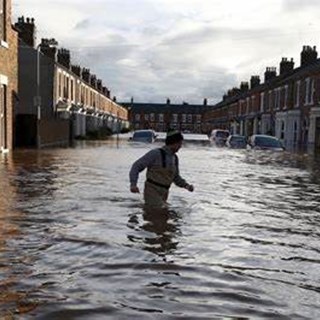
With the UK and beyond facing unprecedented consequences from rising water levels and climate amelioration, BMT are helping our clients in their need for flood alleviation, prediction, mapping and mitigation. James While talks about 5 ways we can assist our clients.
Ian McRobbie
In a Port Strategy feature, Ian McRobbie highlights the merits of optimising bulk transshipment through ‘Climate-Smart’ simulation technology, drawing on extensive project experience