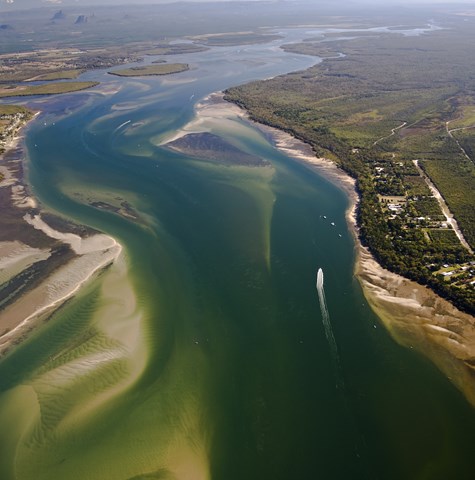
Metocean studies: analysing wind, waves, and climate
We acquire and analyse wind, weather and sea state data to inform design, engineering and operational decision making.
We acquire and analyse wind, weather and sea state data to inform design, engineering and operational decision making.
Key contact

Managing Director, Water & Environment/Senior Principal Engineer
Brisbane, Australia
+61 (0) 7 3831 6744 environment@bmtglobal.comWe acquire and analyse wind, weather and sea state data to inform design, engineering and operational decision-making. We specialise in numerical modelling and satellite remote sensing for the offshore, shipping, and maritime engineering sectors. We offer advanced analysis and prediction of weather and ocean conditions, including:
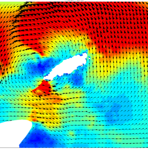
We maintain in-house historical metocean databases, tailored numerical models and a suite of proprietary software for the statistical analysis and extreme value extrapolation of metocean design parameters to ISO standards.
We provide the characterisation of the wind resource by collating existing wind hindcasts, preparing maps and statistical summaries of the wind fields spatial and temporal variability, and operational wind conditions. We offer the added value of holding an in-house curated dataset of satellite observations, which we use for hindcast calibration and enhancing confidence in the characterisation of the wind resource for feasibility and site selection assessments.
Our weather and marine forecasting models include:
We further refine these models through detailed numerical/hydraulic modelling.
Our comprehensive wind resource assessments are conducted under international standards and industry best practices such as the Asian Development Bank Guidelines, National Renewable Energy Laboratory Handbook, US Department of Energy (DOE), International Electrotechnical Commission (IEC), and DNV.
By customising our metocean services, we can provide detailed information about the local climatology, determine the probability of occurrence of suitable weather windows, assess the likely hood of extreme events or provide an assessment of asset performance in the marine environment.
Where there is insufficient existing data to meet a design or operational need, we can support the design and execution of a metocean measurement campaign to obtain additional site-specific data.
With over 35 years of experience and rich heritage of marine research, we apply our understanding of the marine environment to help you make safe and cost-effective decisions that satisfy regulators and reduce risk.
Studies we regularly undertake include:
We help you support a healthy coastal and estuary environment while ensuring that human activities such as fishing, tourism and recreation are protected for future generations.
We work closely with government agencies and industry to fully understand the aquatic ecosystem's factors and ensure that they are managed to the highest standard.
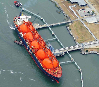
Port operations are optimised by minimising the number of days where operations are halted due to unexpected
Our objective is to identify and support the delivery of sustainable and efficient solutions that will work throughout a port or terminal’s lifetime.