
Beach nourishment monitoring system
We deployed a drone-enabled monitoring system using our BMT Deep platform to assess beach nourishment effectiveness.
We deployed a drone-enabled monitoring system using our BMT Deep platform to assess beach nourishment effectiveness.
Coastal managers needed a reliable way to monitor beach nourishment projects and detect shoreline changes over time to guide future interventions and support regulatory reporting.
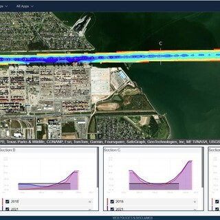
Drone-enabled monitoring system that captured high-resolution imagery and elevation data across nourished beaches.
Photogrammetric processing generated digital elevation models, while automated change detection highlighted areas of erosion or accretion.
The BMT Deep interface enabled time-series comparisons, interactive elevation profiles, and visual tracking of beach evolution over time.
Users could inspect specific locations and generate reports for compliance and stakeholder engagement.
Provided a clear, accessible view of nourishment project performance.
Early detection of erosion allowed for timely management responses, and long-term data supported the optimisation of sand placement strategies.
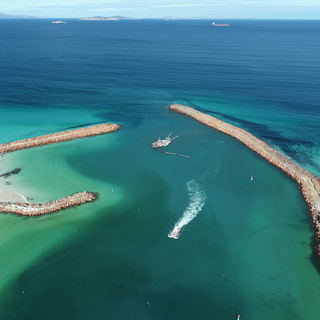
The Bandy Creek Dredging and Castletown Beach Nourishment Project, nominated for a Coastal Adaptation Award, combined dredging and beach nourishment to tackle erosion in Esperance, WA. In partnership with DTMI, SoE, BMT, and Maritime Constructions, it boosted coastal resilience and shoreline protection.
Our predictive dredging solution helps port authorities minimize over-dredging, cut costs, and protect the environment.

Our customer was keen to understand how human behaviours could be best presented within virtual applications, systems and software.

BMT's ADEWS-RAMtr@ck provides the UK MoD with accurate, real-time monitoring of Air Defence and Electronic Warfare assets - enhancing availability, reducing costs, and driving performance-based decision-making.